 Drone Monitoring Platform
Turn Your Drone Work Into Ongoing Value
Most drone work gets delivered once, reviewed once, and then forgotten. AerialTwin helps pilots turn drone scans into ongoing site monitoring that clients and stakeholders can actually use over time.
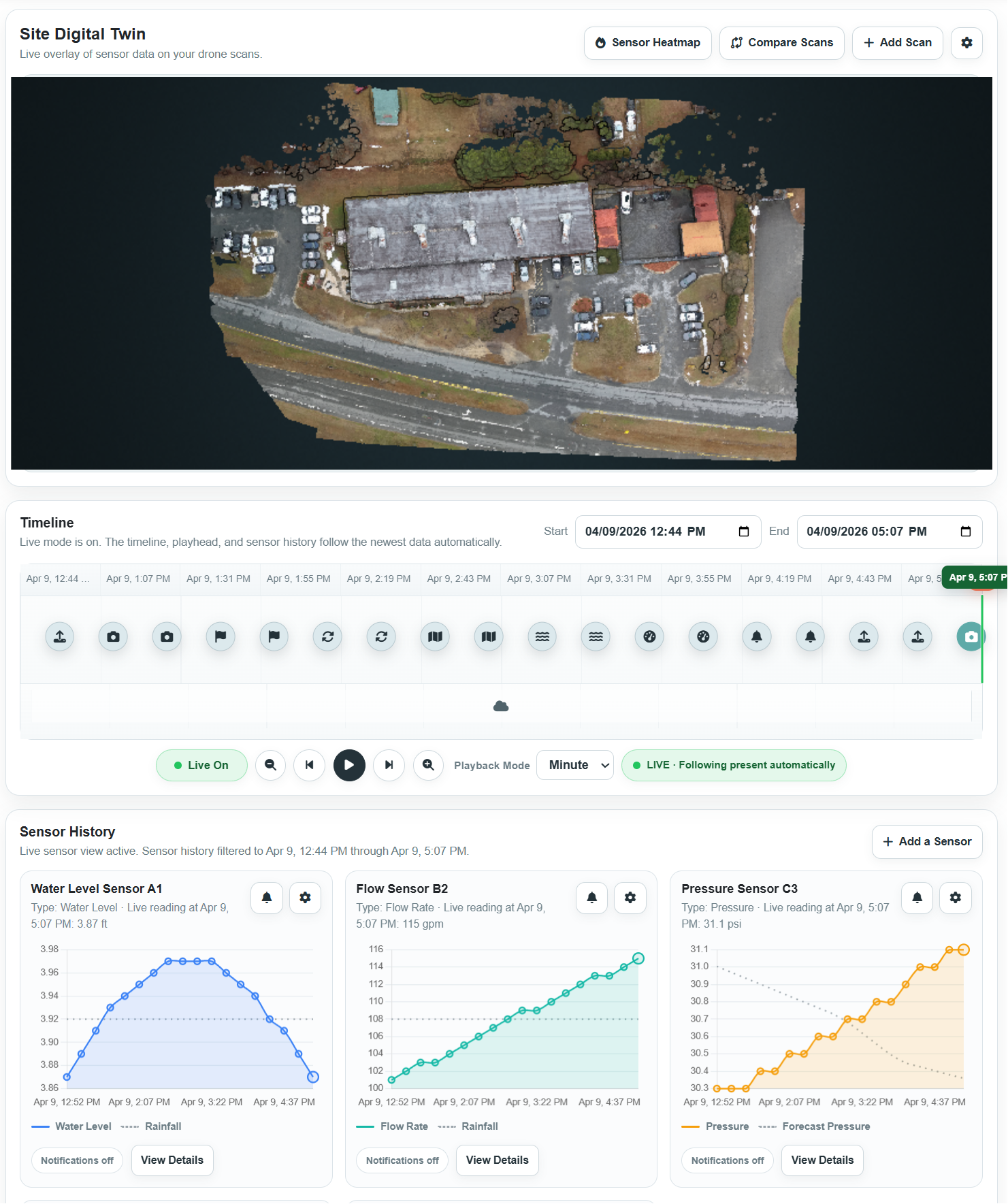
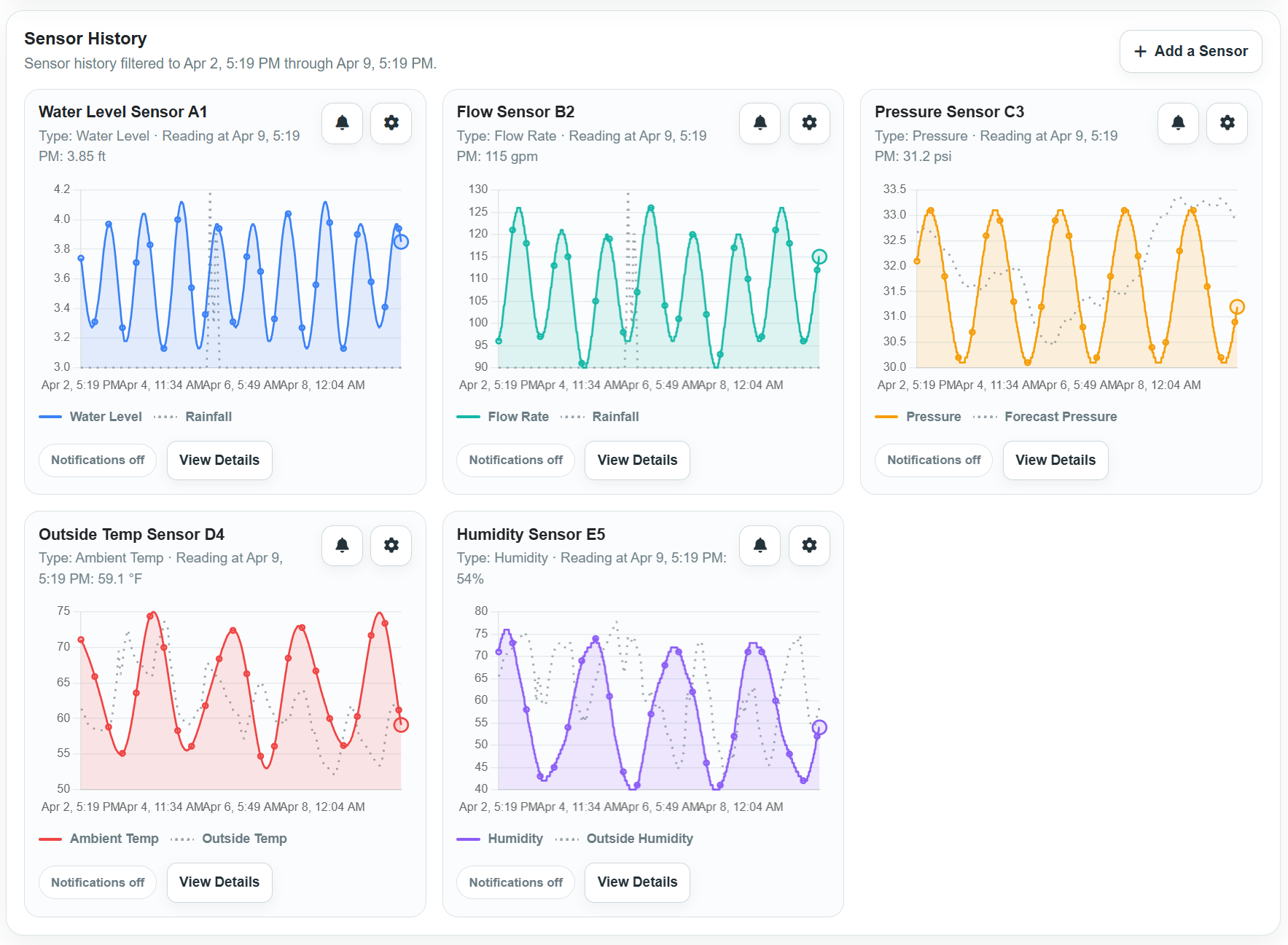
Combine drone scans, historical comparison, and sensor data into one visual system so your work keeps providing value after the flight.
Most Drone Data Stops at Delivery
You capture valuable site data, but without a way to track changes over time, it often becomes a one-time deliverable instead of something people rely on.
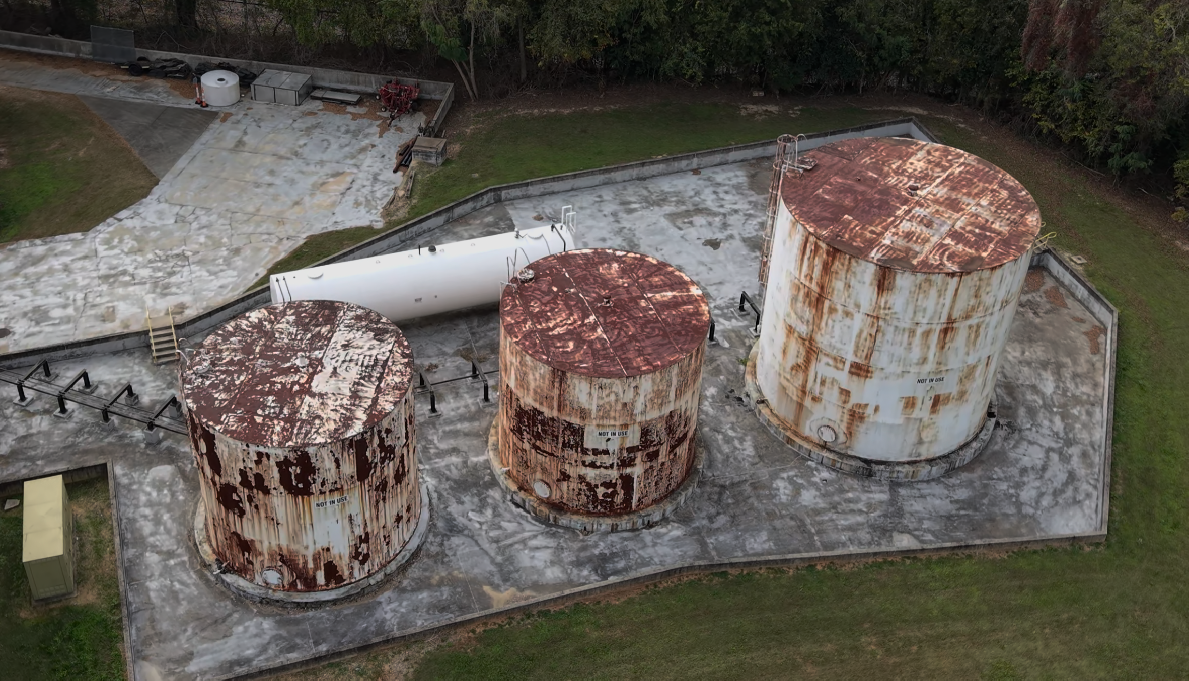
One-time deliverables
- Fly the site and generate a model
- Deliver files, links, or a report
- The client or team reviews it once
- There is no clear reason for them to come back to the data
Ongoing site value
- Track how the site changes over time
- Compare scans and conditions visually
- Connect sensor data to the site model
- Give clients and stakeholders a reason to keep using your work
Turn One Flight Into Ongoing Value
AerialTwin helps you move beyond static deliverables by making drone data useful long after the flight is complete.
Stay involved after the job
Give clients or your internal team a reason to keep using your drone data beyond a single scan.
Show what actually changed
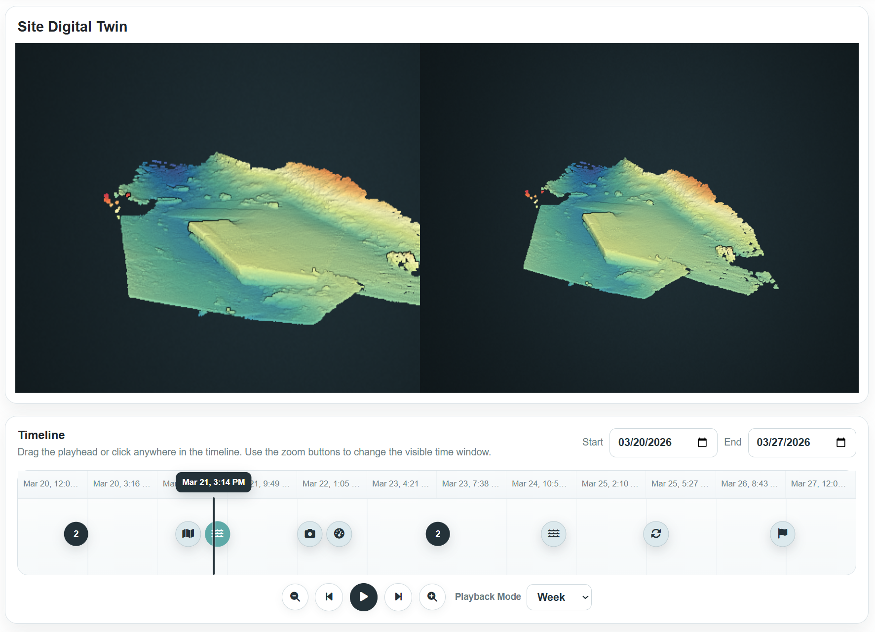
Compare scans over time so stakeholders can understand what changed, when it changed, and why it matters.
Look more valuable
Move from delivering files to delivering ongoing insight that supports better conversations and decisions.
What This Means for You
Whether you fly for clients or work inside an organization, AerialTwin helps make your drone program more useful, more visible, and easier to justify.
Win more repeat work
Instead of delivering one-off models, offer ongoing site monitoring that gives clients a reason to keep working with you.
Justify your drone program
For internal teams, show how drone data supports ongoing visibility instead of becoming another file stored after a flight.
Make your work actually used
Turn scans, models, and sensor readings into a shared system that clients, managers, and field teams can understand.
Most Sites Are Hard to Understand Between Flights
Drone data is powerful, but its value drops when it is disconnected from history, sensors, and the real conditions changing on site.
Delivered once, rarely revisited
Models and maps are often useful at delivery, but they are not always connected to future flights or changing site conditions.
No single place to understand change
Drone scans, sensor readings, notes, photos, and reports usually live in different places instead of telling one clear story.
Limited visibility between visits
When the drone is not flying, teams still need a way to understand what may be changing and where to focus attention next.
From One-Time Deliverables to Ongoing Site Insight
AerialTwin helps you turn drone scans into a living site view by combining 3D context, historical comparison, and sensor information in one place.
Why Drone Teams Use AerialTwin
Built to help drone professionals deliver more useful data, communicate change clearly, and create stronger value for clients or internal stakeholders.
Reduce wasted work
Keep drone scans useful after delivery by connecting them to history, context, and future updates.
Improve communication
Show stakeholders what changed instead of trying to explain it through scattered files or disconnected reports.
Build a site timeline
Give clients and teams context across multiple flights instead of isolated snapshots.
Stand out
Offer a more valuable workflow than pilots who only deliver maps, models, and files.

How It Works
Keep the workflow simple while making the result more valuable.
Capture the site
Start with a drone scan or 3D model that gives the site visual context.
Add ongoing data
Connect sensors, readings, or repeat scans so the site can be tracked over time.
Deliver something people can use
Give stakeholders a way to understand changes, review history, and stay informed between flights.
Make Your Drone Work More Valuable
AerialTwin helps you get more from the same flights by turning your drone data into something that continues to provide value over time.
For hired pilots, that can mean stronger repeat-work opportunities. For internal teams, it can mean a clearer way to show why the drone program matters.
View PricingBuilt for Pilots Working on Real Sites
Construction, infrastructure, land development, utilities, industrial sites, municipalities, and monitored properties.
Anywhere your drone data needs to stay useful after the flight, AerialTwin helps turn captured data into ongoing site insight.
Start Getting More Value From Every Flight
Move beyond one-time drone deliverables. Turn your scans, models, and sensor data into something clients and stakeholders can actually use over time.
AerialTwin provides decision-support insights based on available drone scans, sensor data, and user-provided information. It does not guarantee prevention of failures, future outcomes, or site performance.